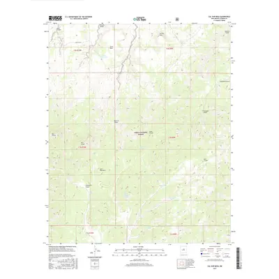
2017 Map of Cal Ship Mesa
USGS Topo · Published 2017About this map
The Datil Mountains anchor this high-altitude landscape within the Cibola National Forest, where water management is the primary signature of human activity. The map reveals a sophisticated network of springs and man-made tanks designed to support ranching and wildlife in a challenging environment. Major landmarks include the elevated plateaus of White Mesa and Cal Ship Mesa, which dominate the northern and central sections.
Find a feature on this map
31 named features on this map. Tap any name to fly to it.
Don’t see what you’re looking for? This feature index may not catch every label — zoom into the map to look around manually.
Map Details
Editions of this 2017 Cal Ship Mesa Map
This is the sole edition of this map. No revisions or reprints were ever made.
Other maps of this area

1954 · Socorro
USGS Topo · 1:250,000

1958 · Socorro
USGS Topo · 1:250,000

1962 · Socorro
USGS Topo · 1:250,000

1963 · Cal Ship Mesa
USGS Topo · 1:24,000

1963 · Datil
USGS Topo · 1:24,000

1964 · Third Canyon
USGS Topo · 1:24,000

1964 · Dog Springs
USGS Topo · 1:24,000

1964 · Pasture Canyon
USGS Topo · 1:24,000
1964 · Madre Mountain
USGS Topo · 1:24,000

1964 · Crosby Springs
USGS Topo · 1:24,000