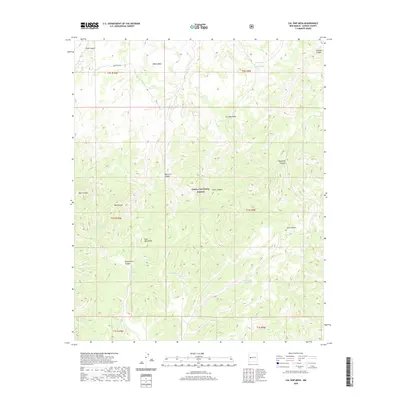
2020 Map of Cal Ship Mesa
USGS Topo · Published 2020About this map
Cibola National Forest encompasses this high-altitude landscape in New Mexico, dominated by the notable profiles of Cal Ship Mesa and White Mesa. The topography is defined by the Datil Mountains, where a complex system of drainages including Red Canyon, Maverick Canyon, and Gooseberry Canyon carve through the terrain. Evidence of water management in this arid environment is clear through features like Government Tank and White Mesa Tank, alongside natural sources such as Stiver Spring, Chavez Spring, and Ox Spring. The road network is sparse, centered primarily around Forest Rd 507, suggesting a wilderness character maintained for conservation and forestry. This map illustrates the high-desert hydrologic patterns where seasonal flow and permanent springs dictate the movement and utility of the land within the national forest system.
Find a feature on this map
30 named features on this map. Tap any name to fly to it.
Don’t see what you’re looking for? This feature index may not catch every label — zoom into the map to look around manually.
Map Details
Editions of this 2020 Cal Ship Mesa Map
This is the sole edition of this map. No revisions or reprints were ever made.
Other maps of this area

1954 · Socorro
USGS Topo · 1:250,000

1958 · Socorro
USGS Topo · 1:250,000

1962 · Socorro
USGS Topo · 1:250,000

1963 · Cal Ship Mesa
USGS Topo · 1:24,000

1963 · Datil
USGS Topo · 1:24,000

1964 · Third Canyon
USGS Topo · 1:24,000

1964 · Dog Springs
USGS Topo · 1:24,000

1964 · Pasture Canyon
USGS Topo · 1:24,000
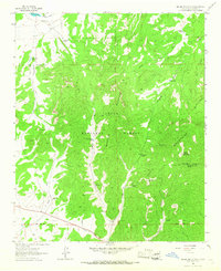
1964 · Madre Mountain
USGS Topo · 1:24,000

1964 · Crosby Springs
USGS Topo · 1:24,000