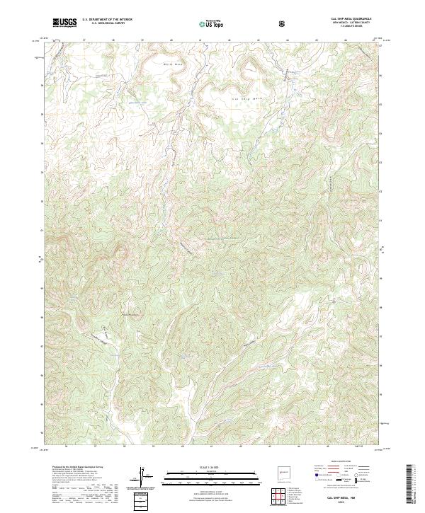
2023 Map of Cal Ship Mesa
USGS Topo · Published 2023About this map
The Datil Mountains and the high plateaus of the Cibola National Forest define this high-altitude landscape in western New Mexico. This 2023 survey illustrates the complex drainage systems of the region, where numerous canyons like Red Canyon, Maverick Canyon, and Main Canyon carve through the tablelands of White Mesa and Cal Ship Mesa. Water sources are critical identifiers for this arid terrain, with several named springs and catchments recorded, including Ox Spring, Silver Spring, and Government Tank. The presence of Forest Rd 507 provides a primary point of access into the timbered uplands. The map provides a contemporary view of these traditional grazing and forest lands, preserving the names of remote landmarks used by generations of ranchers and land managers in Catron County.
Find a feature on this map
30 named features on this map. Tap any name to fly to it.
Don’t see what you’re looking for? This feature index may not catch every label — zoom into the map to look around manually.
Map Details
Editions of this 2023 Cal Ship Mesa Map
This is the sole edition of this map. No revisions or reprints were ever made.
Other maps of this area

1954 · Socorro
USGS Topo · 1:250,000

1958 · Socorro
USGS Topo · 1:250,000

1962 · Socorro
USGS Topo · 1:250,000

1963 · Cal Ship Mesa
USGS Topo · 1:24,000

1963 · Datil
USGS Topo · 1:24,000

1964 · Third Canyon
USGS Topo · 1:24,000

1964 · Dog Springs
USGS Topo · 1:24,000

1964 · Pasture Canyon
USGS Topo · 1:24,000
1964 · Madre Mountain
USGS Topo · 1:24,000

1964 · Crosby Springs
USGS Topo · 1:24,000