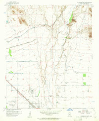
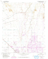
1957 Map of Calderwood Butte
USGS Topo · Published 1961About this map
The braided channels of the Agua Fria River dominate this 1957 landscape, where irrigation infrastructure meets the early expansion of Maricopa County. This period marks a transition from desert ranching and mining toward planned development, anchored by the Atchison Topeka and Santa Fe railroad line running through Lizard Acres. Evidence of deep history is visible in the north near Calderwood Butte, where Indian Ruins and Petroglyphs are recorded along the river banks.
Find a feature on this map
31 named features on this map. Tap any name to fly to it.
Don’t see what you’re looking for? This feature index may not catch every label — zoom into the map to look around manually.
Map Details
Editions of this 1957 Calderwood Butte Map
6 editions found
Other maps of this area

1954 · Phoenix
USGS Topo · 1:250,000

1957 · Phoenix
USGS Topo · 1:250,000

1957 · Calderwood Butte
USGS Topo · 1:24,000

1957 · McMicken Dam
USGS Topo · 1:24,000

1957 · El Mirage
USGS Topo · 1:24,000

1957 · Waddell
USGS Topo · 1:24,000

1957 · Hedgpeth Hills
USGS Topo · 1:24,000

1957 · Glendale
USGS Topo · 1:24,000

1958 · Phoenix
USGS Topo · 1:250,000

1960 · Phoenix
USGS Topo · 1:250,000