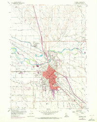
1958 Map of Caldwell
USGS Topo · Published 1972About this map
Caldwell serves as a bustling hub of agricultural and educational activity in this mid-century survey, centered on the College of Idaho and the Union Pacific Railroad. The landscape is defined by an intricate network of irrigation infrastructure essential to the Treasure Valley, including the Phyllis Canal, Farmers Cooperative Canal, and Eureka Canal. These waterways underscore the area's transition from the arid sagebrush plains to a productive farming district. North of the city, the Boise River meanders toward Notus, flanked by features like Canyon Hill and the Caldwell Labor Camp. Educational landmarks are prominent, from the centralized High School and Washington School to the outlying Enrose School and Canyon School, reflecting a well-distributed rural community. The 1971 photorevisions highlight the expansion of Caldwell toward the Caldwell Municipal Airport and along major corridors like Cleveland Boulevard.
Find a feature on this map
97 named features on this map. Tap any name to fly to it.
Don’t see what you’re looking for? This feature index may not catch every label — zoom into the map to look around manually.
Map Details
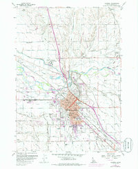
Editions of this 1958 Caldwell Map
3 editions found
Other maps of this area

1898 · Nampa
USGS Topo · 1:125,000

1955 · Boise
USGS Topo · 1:250,000

1957 · Notus
USGS Topo · 1:24,000

1958 · Boise
USGS Topo · 1:250,000
1958 · Middleton
USGS Topo · 1:24,000
1958 · Lake Lowell
USGS Topo · 1:24,000
1958 · Nampa
USGS Topo · 1:24,000
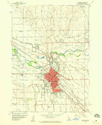
1958 · Caldwell
USGS Topo · 1:24,000
1958 · Marsing
USGS Topo · 1:24,000

1962 · Boise
USGS Topo · 1:250,000