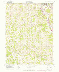
1961 Map of Caldwell South
USGS Topo · Published 1973About this map
Caldwell and the valley of the West Fork Duck Creek anchor this landscape during a period of industrial and agricultural transition in Noble County. The topography is defined by complex drainage systems including Olive Green Creek and Sharon Fork, where numerous small family and community cemeteries such as Manchester Cem, Tiltonville Cem, and Swickard Cem are scattered across the ridges and hollows. The presence of the Penn Central railroad through Dudley indicates the enduring importance of rail transport for the region's extraction economy, underscored by multiple Strip Mine operations marked throughout Sharon and Olive townships. Notable local landmarks like the Fairgrounds near the county seat and rural congregations at Forest Grove Ch provide a clear view of the social fabric connecting the smaller settlements of Keith, Rich Valley, and Crooked Tree.
Find a feature on this map
49 named features on this map. Tap any name to fly to it.
Don’t see what you’re looking for? This feature index may not catch every label — zoom into the map to look around manually.
Map Details
Editions of this 1961 Caldwell South Map
3 editions found
Other maps of this area

1903 · Macksburg
USGS Topo · 1:62,500

1905 · Macksburg
USGS Topo · 1:62,500

1909 · Caldwell
USGS Topo · 1:62,500

1909 · Summerfield
USGS Topo · 1:62,500

1911 · Cumberland
USGS Topo · 1:62,500

1911 · Summerfield
USGS Topo · 1:62,500

1912 · Caldwell
USGS Topo · 1:62,500

1949 · Clarksburg
USGS Topo · 1:250,000

1956 · Clarksburg
USGS Topo · 1:250,000

1961 · Clarksburg
USGS Topo · 1:250,000