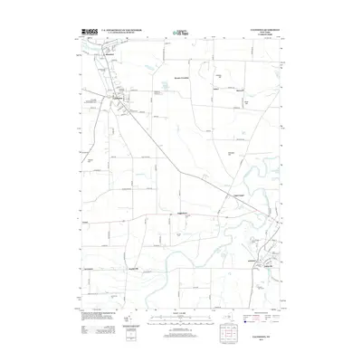
2013 Map of Caledonia
USGS Topo · Published 2013About this map
Caledonia and Mumford anchor this survey of the northern Genesee Valley, where the Oatka Cr and Genesee River define the landscape's hydrological character. The area is dense with legacy sites for genealogists, featuring numerous burial grounds such as the Scottish Cem, Saint Columbus Cem, and Inverness Cem. A unique concentration of infrastructure and community landmarks is evident, from the Caledonia Fish Hatchery to the Tri-County Fair Association Fair Grounds And Race Track. Small crossroads and historic hamlets like Fowlerville, Canawaugus, and Littleville are mapped alongside the expansive agricultural lands and glacial hills, including Finnegan Hill and Collings Hill. The presence of the Cement Plant Pond near Menzie Crossing points to the area's industrial past, while the many roads like Flint Hill Rd and Fowlerville Rd connect these long-established settlements.
Find a feature on this map
77 named features on this map. Tap any name to fly to it.
Don’t see what you’re looking for? This feature index may not catch every label — zoom into the map to look around manually.
Map Details
Editions of this 2013 Caledonia Map
This is the sole edition of this map. No revisions or reprints were ever made.
Other maps of this area

1895 · Rochester
USGS Topo · 1:62,500

1898 · Rochester
USGS Topo · 1:62,500

1899 · Brockport
USGS Topo · 1:62,500

1901 · Honeoye
USGS Topo · 1:62,500

1904 · Caledonia
USGS Topo · 1:62,500

1904 · Honeoye
USGS Topo · 1:62,500

1912 · Rochester
USGS Topo · 1:62,500

1920 · Rochester
USGS Topo · 1:62,500

1934 · Rush
USGS Topo · 1:24,000

1934 · Clifton
USGS Topo · 1:24,000