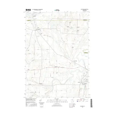
2016 Map of Caledonia
USGS Topo · Published 2016About this map
The Genesee River valley anchors this detailed 2016 survey, illustrating a landscape defined by its glacial heritage and agrarian roots along the Monroe and Livingston county line. The village of Caledonia serves as a primary hub, situated near the headwaters of Oatka Creek and the marshlands of the Cement Plant Pond. Further south, the meandering river passes through Canawaugus, a site of significant indigenous and early pioneer importance, while smaller hamlets like Fowlerville and Inverness mark the rural crossroads. For genealogists, the map is particularly valuable for its precise locations of numerous burial grounds, including the Scottish Cem, Saint Columbus Cem, and Caledonia Rural Cem. Landforms such as Finnegan Hill and Davis Hill rise above the drainage basins of Christie Cr and White Cr, providing a clear view of the elevation changes that have historically dictated road placement and settlement patterns in this region.
Find a feature on this map
83 named features on this map. Tap any name to fly to it.
Don’t see what you’re looking for? This feature index may not catch every label — zoom into the map to look around manually.
Map Details
Editions of this 2016 Caledonia Map
This is the sole edition of this map. No revisions or reprints were ever made.
Other maps of this area

1895 · Rochester
USGS Topo · 1:62,500

1898 · Rochester
USGS Topo · 1:62,500

1899 · Brockport
USGS Topo · 1:62,500

1901 · Honeoye
USGS Topo · 1:62,500

1904 · Caledonia
USGS Topo · 1:62,500

1904 · Honeoye
USGS Topo · 1:62,500

1912 · Rochester
USGS Topo · 1:62,500

1920 · Rochester
USGS Topo · 1:62,500

1934 · Rush
USGS Topo · 1:24,000

1934 · Clifton
USGS Topo · 1:24,000