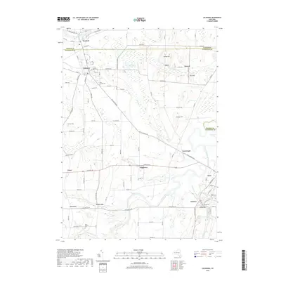
2019 Map of Caledonia
USGS Topo · Published 2019About this map
The Genesee River meanders through the heart of this Western New York landscape, defining the boundary between numerous small settlements and farming tracts. The area is anchored by the village of Caledonia, where traditional street grids like Main St and Center St intersect, while the eastern portion is dominated by the community of Avon. A high concentration of burial grounds provides significant genealogical value, including the Scottish Cem, Saint Columba Cem, and Mount Pleasant Cem.
Find a feature on this map
100 named features on this map. Tap any name to fly to it.
Don’t see what you’re looking for? This feature index may not catch every label — zoom into the map to look around manually.
Map Details
Editions of this 2019 Caledonia Map
This is the sole edition of this map. No revisions or reprints were ever made.
Other maps of this area

1895 · Rochester
USGS Topo · 1:62,500

1898 · Rochester
USGS Topo · 1:62,500

1899 · Brockport
USGS Topo · 1:62,500

1901 · Honeoye
USGS Topo · 1:62,500

1904 · Caledonia
USGS Topo · 1:62,500

1904 · Honeoye
USGS Topo · 1:62,500

1912 · Rochester
USGS Topo · 1:62,500

1920 · Rochester
USGS Topo · 1:62,500

1934 · Rush
USGS Topo · 1:24,000

1934 · Clifton
USGS Topo · 1:24,000