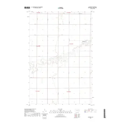
2018 Map of Caledonia
USGS Topo · Published 2018About this map
The settlement of Caledonia sits along a highly sinuous stretch of the Goose River in eastern North Dakota, where the water takes tight, repetitive loops through the agricultural landscape. This survey of the region reveals a strict section-line road network typical of the Red River Valley, punctuated by modern infrastructure such as Mickelson Drain 13 in the northeast corner. While the primary grid is defined by routes like Co Hwy 4 and Co Hwy 13, the river's path remains largely unchannelized, creating complex natural boundaries between the townships of T146N R49W and T146N R50W. Within the village, the intersection of Main St and Co Hwy 2 serves as the central hub for local movement near the river's bend. The map illustrates how late 20th-century drainage projects and long-standing rural routes maintain the productivity of this fertile prairie region.
Find a feature on this map
21 named features on this map. Tap any name to fly to it.
Don’t see what you’re looking for? This feature index may not catch every label — zoom into the map to look around manually.
Map Details
Editions of this 2018 Caledonia Map
This is the sole edition of this map. No revisions or reprints were ever made.
Other maps of this area

1918 · Kelso
USGS Topo · 1:62,500

1918 · Hendrum
USGS Topo · 1:62,500

1919 · Eldred
USGS Topo · 1:62,500

1943 · Kelso
USGS Topo · 1:62,500

1952 · Grand Forks
USGS Topo · 1:250,000

1956 · Grand Forks
USGS Topo · 1:250,000

1963 · Shelly
USGS Topo · 1:24,000

1963 · Halstad
USGS Topo · 1:24,000

1963 · Hillsboro
USGS Topo · 1:24,000

1963 · Kelso
USGS Topo · 1:24,000