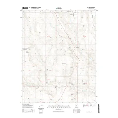
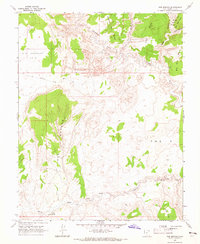
2014 Map of Calf Creek
USGS Topo · Published 2014About this map
Boulder Town sits at the northern edge of this high-desert plateau, marking a gateway to the intricate canyon systems carved by the Escalante River. The terrain is defined by dramatic elevation changes across massive sandstone formations, including the prominent ridge known as The Hogback. Natural landmarks are abundant throughout the drainage of Calf Creek, which features both Upper Calf Creek Falls and Lower Calf Creek Falls. This area is a focal point for geographical study, containing several significant geological spans such as the Escalante Natural Bridge, Bowington Arch, and Phipps Arch. Human footprint is concentrated along the Ut-12 corridor and within the Calf Creek Recreation Area, while the surrounding benches like Bowington Bench and Haymaker Bench illustrate the expansive, uninhabited nature of the Phipps-Death Hollow Outstanding Natural Area as it appeared in the early 21st century.
Find a feature on this map
54 named features on this map. Tap any name to fly to it.
Don’t see what you’re looking for? This feature index may not catch every label — zoom into the map to look around manually.
Map Details
Editions of this 2014 Calf Creek Map
This is the sole edition of this map. No revisions or reprints were ever made.
Other maps of this area

1886 · Escalante
USGS Topo · 1:250,000

1953 · Circle Cliffs 2 NE
USGS Topo · 1:24,000

1956 · Escalante
USGS Topo · 1:250,000

1960 · Escalante
USGS Topo · 1:250,000

1964 · Tenmile Flat
USGS Topo · 1:24,000
1964 · King Bench
USGS Topo · 1:24,000

1964 · Dave Canyon
USGS Topo · 1:24,000
1964 · Calf Creek
USGS Topo · 1:24,000
1964 · Steep Creek Bench
USGS Topo · 1:24,000
1964 · Red Breaks
USGS Topo · 1:24,000