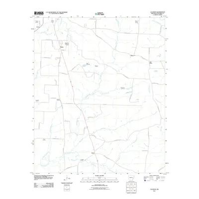
2011 Map of Calhoun
USGS Topo · Published 2011About this map
Calhoun oil and gas production defines the industrial landscape of Columbia County in the early 21st century. This survey reveals a complex network of energy extraction, specifically the Magnolia Oil and Gas Field and the Calhoun Oil and Gas Field, interspersed with rural settlements and timberland. The presence of the Magnolia Municipal Airport near Walker and Partee highlights the area's infrastructure, while local heritage is preserved in sites like the Kings Hill Cemetery and Jerusalem Cemetery. The hydrology is dominated by a dense web of branches and creeks, including Horsehead Creek and the Little Cornie Bayou, which navigate the subtle elevations of the South Arkansas terrain. Smaller communities such as Brister and Kerlin are connected by a grid of county roads that navigate between wetlands like Miller Lake and the various oil fields that have shaped the local economy for decades.
Find a feature on this map
61 named features on this map. Tap any name to fly to it.
Don’t see what you’re looking for? This feature index may not catch every label — zoom into the map to look around manually.
Map Details
Editions of this 2011 Calhoun Map
This is the sole edition of this map. No revisions or reprints were ever made.
Other maps of this area

1953 · El Dorado
USGS Topo · 1:250,000

1957 · El Dorado
USGS Topo · 1:250,000

1958 · El Dorado
USGS Topo · 1:250,000

1960 · El Dorado
USGS Topo · 1:250,000

1960 · Walkerville
USGS Topo · 1:24,000

1960 · Macedonia
USGS Topo · 1:24,000

1966 · Village
USGS Topo · 1:24,000

1966 · Calhoun
USGS Topo · 1:24,000

1966 · Spotville
USGS Topo · 1:24,000

1968 · Waldo
USGS Topo · 1:24,000