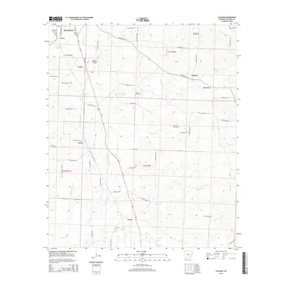
2014 Map of Calhoun
USGS Topo · Published 2014About this map
The southern outskirts of Magnolia give way to a landscape defined by the intersection of rural life and the petroleum industry in this 2014 survey. Resource extraction is a primary feature of the terrain, with the Columbia Oil and Gas Field and the Magnolia Oil and Gas Field occupying significant portions of the northern and central sections. Small, established communities like Brister, Calhoun, and Kerlin are connected by an extensive network of county roads, including Columbia Road 30 and Columbia Road 11 E, illustrating the late-modern settlement pattern of Columbia County. Natural drainage is dictated by numerous creeks and branches, most notably Horsehead Cr and the winding Little Cornie Bayou. For those researching local heritage, several historic burial grounds are noted across the quadrangle, including Kings Hill Cem, Jerusalem Cem, and Owen Cem.
Find a feature on this map
68 named features on this map. Tap any name to fly to it.
Don’t see what you’re looking for? This feature index may not catch every label — zoom into the map to look around manually.
Map Details
Editions of this 2014 Calhoun Map
This is the sole edition of this map. No revisions or reprints were ever made.
Other maps of this area

1953 · El Dorado
USGS Topo · 1:250,000

1957 · El Dorado
USGS Topo · 1:250,000

1958 · El Dorado
USGS Topo · 1:250,000

1960 · El Dorado
USGS Topo · 1:250,000

1960 · Walkerville
USGS Topo · 1:24,000

1960 · Macedonia
USGS Topo · 1:24,000

1966 · Village
USGS Topo · 1:24,000

1966 · Calhoun
USGS Topo · 1:24,000

1966 · Spotville
USGS Topo · 1:24,000

1968 · Waldo
USGS Topo · 1:24,000