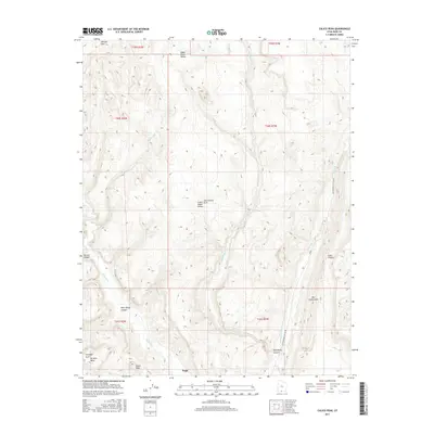
2017 Map of Calico Peak
USGS Topo · Published 2017About this map
Paria serves as a central reference point in this corner of Kane County, situated along the winding course of the Paria River. The landscape is defined by its dramatic geological formations, most notably the elongated ridge of The Cockscomb and the high elevation of Calico Peak. This 2017 survey details a network of canyons and mesas, including Hackberry Canyon and the isolated No Mans Mesa. Navigation through this complex terrain is facilitated primarily by Cottonwood Canyon Rd, which snakes through the eastern portion of the quadrangle. Significant natural landmarks such as Sam Pollock Arch and Starlight Arch are documented, providing precise locations for features within Upper Death Valley and Lower Death Valley. The drainage patterns of Hackberry Cr and Cottonwood Cr further illustrate the deeply eroded nature of the region.
Find a feature on this map
24 named features on this map. Tap any name to fly to it.
Don’t see what you’re looking for? This feature index may not catch every label — zoom into the map to look around manually.
Map Details
Editions of this 2017 Calico Peak Map
This is the sole edition of this map. No revisions or reprints were ever made.
Other maps of this area

1886 · Kanab
USGS Topo · 1:250,000

1886 · Escalante
USGS Topo · 1:250,000

1953 · Cedar City
USGS Topo · 1:250,000

1954 · Buckskin Gulch NE
USGS Topo · 1:24,000

1954 · Paria NW
USGS Topo · 1:24,000

1954 · Buckskin Gulch
USGS Topo · 1:62,500

1954 · Paria
USGS Topo · 1:62,500

1955 · The Cockscob SW
USGS Topo · 1:24,000

1956 · Escalante
USGS Topo · 1:250,000

1958 · Cedar City
USGS Topo · 1:250,000