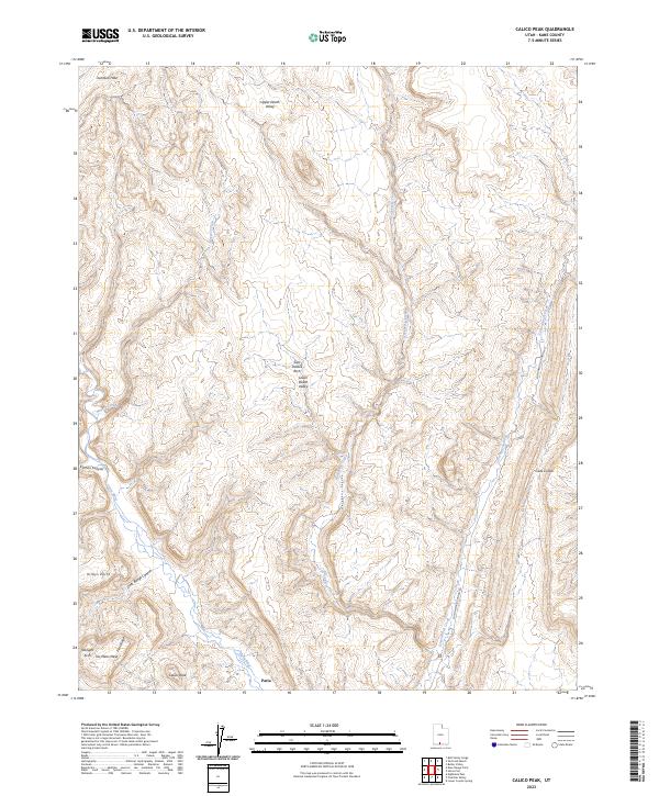
2023 Map of Calico Peak
USGS Topo · Published 2023About this map
Paria serves as a key landmark in this corner of Kane County, situated where the Paria River meets the drainages of Hackberry Canyon and Cottonwood Creek. The landscape is defined by massive formations and dramatic erosional features, including No Mans Mesa and the prominent Calico Peak to the south. The area is a labyrinth of named canyons and valleys, from the sweeping Upper Death Valley and Lower Death Valley to the uniquely named Cads Crotch near the eastern boundary.
Find a feature on this map
19 named features on this map. Tap any name to fly to it.
Don’t see what you’re looking for? This feature index may not catch every label — zoom into the map to look around manually.
Map Details
Editions of this 2023 Calico Peak Map
This is the sole edition of this map. No revisions or reprints were ever made.
Other maps of this area

1886 · Kanab
USGS Topo · 1:250,000

1886 · Escalante
USGS Topo · 1:250,000

1953 · Cedar City
USGS Topo · 1:250,000

1954 · Buckskin Gulch NE
USGS Topo · 1:24,000

1954 · Paria NW
USGS Topo · 1:24,000

1954 · Buckskin Gulch
USGS Topo · 1:62,500

1954 · Paria
USGS Topo · 1:62,500

1955 · The Cockscob SW
USGS Topo · 1:24,000

1956 · Escalante
USGS Topo · 1:250,000

1958 · Cedar City
USGS Topo · 1:250,000