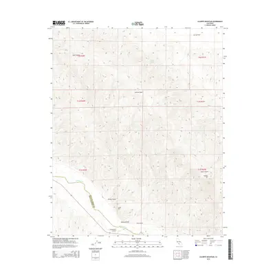
2015 Map of Caliente Mountain
USGS Topo · Published 2015About this map
Caliente Mtn anchors this section of the Central Coast interior, where the high ridges of the Caliente Range drop sharply toward the south. The landscape is defined by the course of the Cuyama River, which traces the southwestern border of the quadrangle alongside Highway 166. This corridor represents a vital drainage point for the surrounding highlands, including Morales Canyon and Schoolhouse Canyon. To the northeast, the terrain levels out into the southern reaches of the Carrizo Plain. Scattered water sources like Black Sulphur Spring and Goat Spring provide critical landmarks in an otherwise arid environment. The map also delineates the high-altitude boundary between San Luis Obispo and Santa Barbara counties as it traverses the prominent peak of the range, offering a clear view of the complex topography near Whiterock Bluff.
Find a feature on this map
22 named features on this map. Tap any name to fly to it.
Don’t see what you’re looking for? This feature index may not catch every label — zoom into the map to look around manually.
Map Details
Editions of this 2015 Caliente Mountain Map
This is the sole edition of this map. No revisions or reprints were ever made.
Other maps of this area

1902 · Santa Ynez
USGS Topo · 1:125,000

1905 · Santa Ynez
USGS Topo · 1:125,000

1912 · McKittrick
USGS Topo · 1:125,000

1941 · Caliente Mountain
USGS Topo · 1:62,500

1941 · McPherson Peak
USGS Topo · 1:62,500

1942 · Caliente Mtn
USGS Topo · 1:62,500

1943 · McPherson Peak
USGS Topo · 1:62,500

1943 · Caliente Mtn.
USGS Topo · 1:62,500

1943 · Cuyama Ranch
USGS Topo · 1:31,680

1944 · Panorama Hills
USGS Topo · 1:31,680