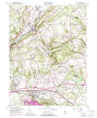
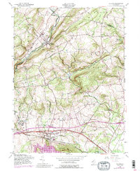
1954 Map of Califon
USGS Topo · Published 1988About this map
The South Branch Raritan River carves through the landscape of northern Hunterdon County, anchoring the settlement of Califon where it meets the Central Railroad of New Jersey. This mid-century survey illustrates a complex rural network of small hamlets like Cokesbury, Mountainville, and Oldwick, connected by early routes such as New Jersey 513. The geography is defined by the steep rises of the Fox Hill Range and Hell Mtn, while the southern portion of the map transitions toward the flatter corridor of Lebanon and the prominent Round Valley Reservoir. Historical researchers will find significant civic and institutional detail, including the State Reformatory near Cedar Heights and several rural schools like Township Sch and Bissell Sch. The presence of numerous family-linked sites, from McCrea Mills to Mountain View Cem, provides a detailed look at the local genealogy and land use prior to the suburban expansions of the late 20th century.
Find a feature on this map
44 named features on this map. Tap any name to fly to it.
Don’t see what you’re looking for? This feature index may not catch every label — zoom into the map to look around manually.
Map Details
Editions of this 1954 Califon Map
5 editions found
Other maps of this area

1888 · Hackettstown
USGS Topo · 1:62,500

1888 · Lake Hopatcong
USGS Topo · 1:62,500

1890 · High Bridge
USGS Topo · 1:62,500

1891 · Somerville
USGS Topo · 1:62,500

1893 · Somerville
USGS Topo · 1:62,500

1894 · Hackettstown
USGS Topo · 1:62,500

1894 · Lake Hopatcong
USGS Topo · 1:62,500

1898 · Lake Hopatcong
USGS Topo · 1:62,500

1898 · Hackettstown
USGS Topo · 1:62,500

1898 · High Bridge
USGS Topo · 1:62,500