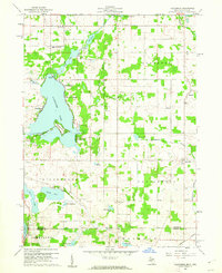
1960 Map of California
USGS Topo · Published 1962About this map
Coldwater Lake dominates the western half of this Branch County landscape, characterized by its complex shoreline and seasonal recreational clusters like Crystal Beach, Sans Souci Beach, and Pearl Beach. The map documents a rural agricultural and lakeside community at the start of the 1960s, with development concentrated around the water's edge and the small settlement of California in the southeast. An interesting cultural marker is the Amish Sch located north of California, indicating the presence of traditional communities alongside the expanding summer resorts.
Find a feature on this map
43 named features on this map. Tap any name to fly to it.
Don’t see what you’re looking for? This feature index may not catch every label — zoom into the map to look around manually.
Map Details
Editions of this 1960 California Map
2 editions found
Other maps of this area

1939 · Angola East
USGS Topo · 1:24,000

1939 · Clear Lake
USGS Topo · 1:24,000

1940 · Clear Lake
USGS Topo · 1:24,000

1941 · Angola West
USGS Topo · 1:24,000

1942 · Angola West
USGS Topo · 1:24,000

1947 · Angola East
USGS Topo · 1:24,000

1953 · Fort Wayne
USGS Topo · 1:250,000

1956 · Fort Wayne
USGS Topo · 1:250,000

1960 · Coldwater West
USGS Topo · 1:24,000

1960 · Coldwater East
USGS Topo · 1:24,000