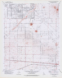
1973 Map of California City South
USGS Topo · Published 1976About this map
California City expanded across the desert landscape during the early 1970s, as shown by the extensive grid of residential streets like Great Circle and Isabella Blvd. This planned development is anchored by civic features such as Ulrich Sch and is physically constrained by natural landmarks like Cache Creek and the Desert Butte rise. The southern portion of the sheet transitions from these emerging residential neighborhoods into the industrial and military infrastructure that defines the region's economy.
Find a feature on this map
39 named features on this map. Tap any name to fly to it.
Don’t see what you’re looking for? This feature index may not catch every label — zoom into the map to look around manually.
Map Details
Editions of this 1973 California City South Map
2 editions found
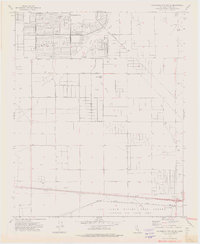
Other maps of this area

1915 · Elizabeth Lake
USGS Topo · 1:125,000

1915 · Searles Lake
USGS Topo · 1:250,000

1915 · Mojave
USGS Topo · 1:125,000

1917 · Elizabeth Lake
USGS Topo · 1:125,000

1937 · Rogers Lake
USGS Topo · 1:48,000

1942 · Rogers Lake
USGS Topo · 1:62,500

1943 · Rosamond
USGS Topo · 1:62,500

1943 · Castle Butte
USGS Topo · 1:62,500

1943 · Mojave
USGS Topo · 1:62,500

1947 · Fluhr
USGS Topo · 1:24,000