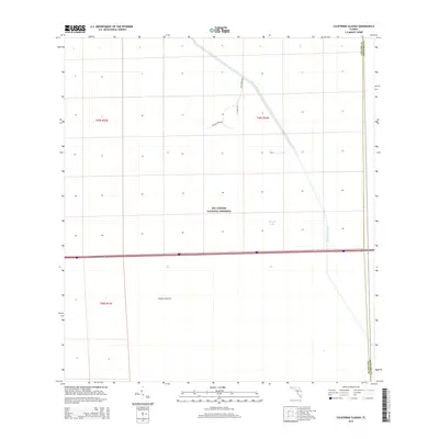
2015 Map of California Slough
USGS Topo · Published 2015About this map
Big Cypress National Preserve defines the vast majority of this landscape at the boundary of Collier and Broward counties. The terrain is characterized by the expansive wetland of Doctors Prairie and the slow-moving waters of California Slough. Human engineering is evident in the straight course of the Interceptor Canal, which cuts through the native hydrology to manage water flow across the region. A handful of access routes, including Big Cypress Rd, Miller Rd, and Upper Creek Rd, penetrate this protected wilderness, providing a rare glimpse into the interior of the Everglades ecosystem as it existed in the early twenty-first century. This survey documents the intersection of natural drainage patterns and mid-century water management infrastructure near Tarpan Lake.
Find a feature on this map
12 named features on this map. Tap any name to fly to it.
Don’t see what you’re looking for? This feature index may not catch every label — zoom into the map to look around manually.
Map Details
Editions of this 2015 California Slough Map
This is the sole edition of this map. No revisions or reprints were ever made.
Other maps of this area

1956 · West Palm Beach
USGS Topo · 1:250,000

1957 · West Palm Beach
USGS Topo · 1:250,000

1958 · West Palm Beach
USGS Topo · 1:250,000

1973 · Everglades 3 NE
USGS Topo · 1:24,000

1974 · Everglades 2 SW
USGS Topo · 1:24,000

1974 · Immokalee 1 SE
USGS Topo · 1:24,000

1974 · Everglades 2 SE
USGS Topo · 1:24,000
1974 · Everglades 3 SW
USGS Topo · 1:24,000
1974 · Immokalee 4 NE
USGS Topo · 1:24,000
1974 · Everglades 3 NW
USGS Topo · 1:24,000