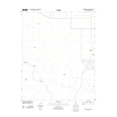
2012 Map of California Valley
USGS Topo · Published 2012About this map
California Valley is situated within an arid landscape defined by the drainage systems of San Juan Cr and Rogers Cr. The settlement pattern here is highly distinctive, featuring a vast, geometric grid of residential roads—many with alphabetical or thematic names like Gem Rd, Grape Rd, and Gulf Rd—stretching across the flats west of Soda Lake Rd. This planned layout contrasts sharply with the surrounding topography, which is dominated by prominent elevations such as Syncline Hill, Hubbard Hill, and Freeborn Mountain. The presence of the California Valley Airport and a network of desert tracks like Cattle Dr and Tracy Ln suggests a community organized around remote ranching and wide-open spaces. Evidence of the region's complex geology and erosion is found in the deep incisions of Lower Piletas Canyon and Buckhorn Canyon that carve through the hillsides.
Find a feature on this map
29 named features on this map. Tap any name to fly to it.
Don’t see what you’re looking for? This feature index may not catch every label — zoom into the map to look around manually.
Map Details
Editions of this 2012 California Valley Map
This is the sole edition of this map. No revisions or reprints were ever made.
Other maps of this area

1912 · McKittrick
USGS Topo · 1:125,000

1932 · La Panza
USGS Topo · 1:48,000

1935 · La Panza
USGS Topo · 1:62,500

1936 · La Panza
USGS Topo · 1:62,500

1937 · Branch Mtn
USGS Topo · 1:48,000

1941 · Caliente Mountain
USGS Topo · 1:62,500

1942 · Branch Mountain
USGS Topo · 1:62,500

1942 · Caliente Mtn
USGS Topo · 1:62,500

1943 · Simmler
USGS Topo · 1:62,500

1943 · Caliente Mtn.
USGS Topo · 1:62,500