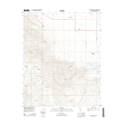
2015 Map of California Valley
USGS Topo · Published 2015About this map
The California Valley and the expansive Carrizo Plain define this landscape in eastern San Luis Obispo County. This high-altitude basin is characterized by a grid of residential roads—including Soda Lake Rd and Garnet Rd—that contrast with the complex topography to the west. The rugged terrain transitions into a series of notable peaks and drainages, including Freeborn Mtn, Hubbard Hill, and the unique geological formation of Syncline Hill. Seasonal watercourses like San Juan Cr and Rogers Cr carve through numerous named canyons such as Buckhorn Canyon and Old Canyon. The settlement pattern in the valley shows a planned community layout adjacent to the vast open spaces of the Temblor Range foothills, offering a detailed record of land use and geography in this distinct semi-arid environment.
Find a feature on this map
36 named features on this map. Tap any name to fly to it.
Don’t see what you’re looking for? This feature index may not catch every label — zoom into the map to look around manually.
Map Details
Editions of this 2015 California Valley Map
This is the sole edition of this map. No revisions or reprints were ever made.
Other maps of this area

1912 · McKittrick
USGS Topo · 1:125,000

1932 · La Panza
USGS Topo · 1:48,000

1935 · La Panza
USGS Topo · 1:62,500

1936 · La Panza
USGS Topo · 1:62,500

1937 · Branch Mtn
USGS Topo · 1:48,000

1941 · Caliente Mountain
USGS Topo · 1:62,500

1942 · Branch Mountain
USGS Topo · 1:62,500

1942 · Caliente Mtn
USGS Topo · 1:62,500

1943 · Simmler
USGS Topo · 1:62,500

1943 · Caliente Mtn.
USGS Topo · 1:62,500