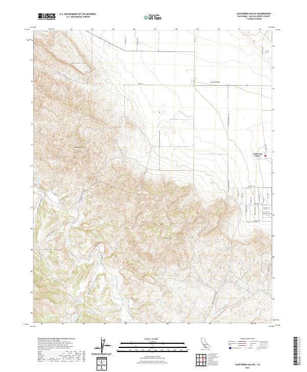
2021 Map of California Valley
USGS Topo · Published 2021About this map
California Valley lies at the eastern edge of the La Panza Range in this high-desert landscape within San Luis Obispo County. The map details the transition from the steep, canyon-cut mountains into the level expanse of the Carrizo Plain. This area is defined by its dramatic topographic relief, where features like Syncline Hill, Hubbard Hill, and Freeborn Mtn overlook a complex network of seasonal drainages, including San Juan Creek and its tributaries like Rogers Creek.
Find a feature on this map
40 named features on this map. Tap any name to fly to it.
Don’t see what you’re looking for? This feature index may not catch every label — zoom into the map to look around manually.
Map Details
Editions of this 2021 California Valley Map
This is the sole edition of this map. No revisions or reprints were ever made.
Other maps of this area

1912 · McKittrick
USGS Topo · 1:125,000

1932 · La Panza
USGS Topo · 1:48,000

1935 · La Panza
USGS Topo · 1:62,500

1936 · La Panza
USGS Topo · 1:62,500

1937 · Branch Mtn
USGS Topo · 1:48,000

1941 · Caliente Mountain
USGS Topo · 1:62,500

1942 · Branch Mountain
USGS Topo · 1:62,500

1942 · Caliente Mtn
USGS Topo · 1:62,500

1943 · Simmler
USGS Topo · 1:62,500

1943 · Caliente Mtn.
USGS Topo · 1:62,500