
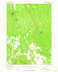
1956 Map of Calimus Butte
USGS Topo · Published 1959About this map
The high plateau of the Klamath Indian Reservation defines this mid-century landscape, where rugged timberlands meet the winding watercourse of the Sprague River. This 1956 survey records a transition from high-desert wilderness to scattered ranching outposts along the river valley floor. The northern sections are dominated by prominent volcanic landforms like Calimus Butte, while the south reveals the agricultural footprint of the McCready Ranch and the decaying structures of Ray Ranch (Ruins). This map provides an essential record of the reservation's geography and the network of old logging grades and forest roads that serviced the timber industry before significant modern development altered the area's isolation.
Find a feature on this map
2 named features on this map. Tap any name to fly to it.
Don’t see what you’re looking for? This feature index may not catch every label — zoom into the map to look around manually.
Map Details
Editions of this 1956 Calimus Butte Map
2 editions found
Other maps of this area

1889 · Klamath
USGS Topo · 1:250,000

1894 · Klamath
USGS Topo · 1:250,000

1955 · Klamath Falls
USGS Topo · 1:250,000

1957 · Chiloquin
USGS Topo · 1:62,500

1957 · Klamath Marsh
USGS Topo · 1:62,500

1957 · Swan Lake
USGS Topo · 1:62,500

1957 · Lenz
USGS Topo · 1:62,500

1957 · Modoc Point
USGS Topo · 1:62,500

1958 · Klamath Falls
USGS Topo · 1:250,000

1960 · Beatty
USGS Topo · 1:62,500