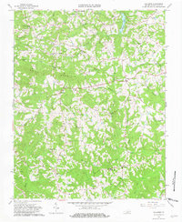
1965 Map of Callands
USGS Topo · Published 1981About this map
The settlement of Callands serves as a central point in this mid-1960s landscape, where the rural topography of Pittsylvania County is defined by its numerous small-scale farming communities and extensive drainage networks. The terrain is notably dominated by the ridge of Brier Mountain, with several church-centered hubs like Christian Tabernacle and Matthews Memorial Ch anchoring the local population. Significant water bodies and waterways, including Burton Lake and the winding Banister River, illustrate the hydraulic geography of the region. Local history and genealogy are deeply embedded in the map's details, from the naming of Hollys Mill and the Gregory Cem to the presence of the Cherrystone Youth Camp. The distribution of dozens of small cemeteries and local landmarks like Worlds and Rondo reveals the dispersed settlement patterns characteristic of Virginia's Piedmont region during this era.
Find a feature on this map
35 named features on this map. Tap any name to fly to it.
Don’t see what you’re looking for? This feature index may not catch every label — zoom into the map to look around manually.
Map Details
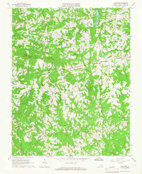
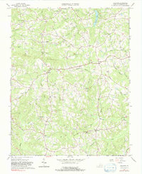
Editions of this 1965 Callands Map
3 editions found
Other maps of this area

1921 · Chatham
USGS Topo · 1:48,000

1922 · Callands
USGS Topo · 1:48,000

1923 · Danville
USGS Topo · 1:48,000

1923 · Chatham
USGS Topo · 1:62,500

1924 · Draper
USGS Topo · 1:48,000

1924 · Callands
USGS Topo · 1:62,500

1925 · Danville
USGS Topo · 1:62,500

1926 · Draper
USGS Topo · 1:62,500

1944 · Draper
USGS Topo · 1:62,500

1944 · Callands
USGS Topo · 1:62,500