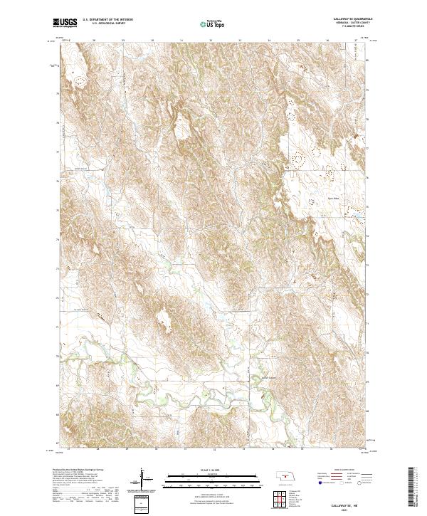
2021 Map of Callaway SE
USGS Topo · Published 2021About this map
The South Loup River winds through this section of Custer County, shaping a landscape defined by deep draws and high plateaus. The topography is dominated by the Ryno Table, a prominent elevated flat that stands in contrast to the nearby incisions of Custer Canyon and Yellow Dog Canyon. These geological formations, along with the drainage of Spring Cr and Ash Cr, create a complex network of ridges and valleys typical of Nebraska's central sandhills edge.
Find a feature on this map
31 named features on this map. Tap any name to fly to it.
Don’t see what you’re looking for? This feature index may not catch every label — zoom into the map to look around manually.
Map Details
Editions of this 2021 Callaway SE Map
This is the sole edition of this map. No revisions or reprints were ever made.
Other maps of this area

1951 · Broken Bow SW
USGS Topo · 1:24,000

1951 · Callaway NW
USGS Topo · 1:24,000

1951 · Broken Bow
USGS Topo · 1:24,000

1951 · Merna
USGS Topo · 1:24,000

1951 · Callaway SE
USGS Topo · 1:24,000

1951 · Callaway
USGS Topo · 1:24,000

1951 · Eddyville NW
USGS Topo · 1:24,000

1951 · Oconto NW
USGS Topo · 1:24,000

1951 · Oconto
USGS Topo · 1:24,000

1955 · Broken Bow
USGS Topo · 1:250,000