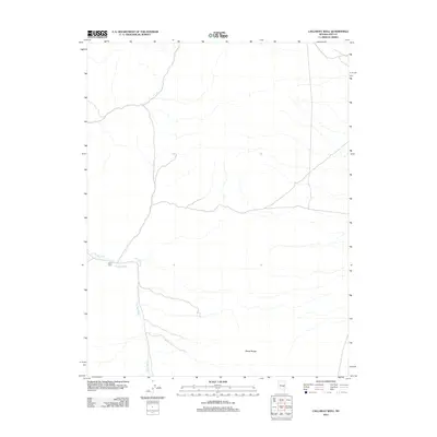
2012 Map of Callaway Well
USGS Topo · Published 2012About this map
Stone Cabin stands as a solitary waypoint in this arid pocket of Nye County, Nevada. The landscape is defined by the shifting drainage patterns of The Big Wash, which winds through the basin toward the south and west. This 2012 survey illustrates the sparse water infrastructure essential for life in the high desert, centered on the eponymous Callaway Well. To the southeast, the terrain rises into the Horse Range, where the elevation change dictates the path of dry washes and unpaved roads. The map reveals a land of vast open space where human presence is marked by isolated structures and vital water sources, providing a clear view of the region's ranching and topographical character in the early 21st century.
Find a feature on this map
4 named features on this map. Tap any name to fly to it.
Don’t see what you’re looking for? This feature index may not catch every label — zoom into the map to look around manually.
Map Details
Editions of this 2012 Callaway Well Map
This is the sole edition of this map. No revisions or reprints were ever made.
Other maps of this area

1956 · Lund
USGS Topo · 1:250,000

1957 · Currant Mtn
USGS Topo · 1:62,500

1960 · Lund
USGS Topo · 1:250,000

1964 · Currant
USGS Topo · 1:62,500

1964 · Currant Mtn
USGS Topo · 1:62,500

1969 · Moorman Spring NW
USGS Topo · 1:24,000

1969 · Moorman Spring
USGS Topo · 1:24,000
1978 · Douglas
USGS Topo · 1:24,000

1980 · Duckwater
USGS Topo · 1:100,000
1990 · Wells Station
USGS Topo · 1:24,000