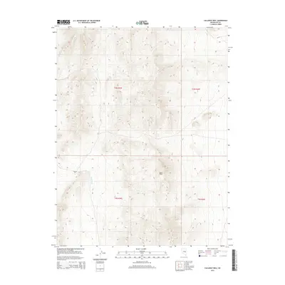
2014 Map of Callaway Well
USGS Topo · Published 2014About this map
Callaway Well serves as the primary named point of human activity in this arid corner of Nye County, where the high desert terrain of the Horse Range dominates the landscape. The topographic data reflects a complex environment of shifting elevations and dry drainage patterns, most notably The Big Wash, which cuts through the southern portion of the quadrangle. This 2014 survey captures the area within the Public Land Survey System grids of t10n r59e, t10n r60e, t9n r59e, and t9n r60e. The map illustrates the isolation of the Great Basin, focusing on the essential water sources and mountain ranges that have historically dictated movement and land use in this part of Nevada.
Find a feature on this map
7 named features on this map. Tap any name to fly to it.
Don’t see what you’re looking for? This feature index may not catch every label — zoom into the map to look around manually.
Map Details
Editions of this 2014 Callaway Well Map
This is the sole edition of this map. No revisions or reprints were ever made.
Other maps of this area

1956 · Lund
USGS Topo · 1:250,000

1957 · Currant Mtn
USGS Topo · 1:62,500

1960 · Lund
USGS Topo · 1:250,000

1964 · Currant
USGS Topo · 1:62,500

1964 · Currant Mtn
USGS Topo · 1:62,500

1969 · Moorman Spring NW
USGS Topo · 1:24,000

1969 · Moorman Spring
USGS Topo · 1:24,000
1978 · Douglas
USGS Topo · 1:24,000

1980 · Duckwater
USGS Topo · 1:100,000
1990 · Wells Station
USGS Topo · 1:24,000