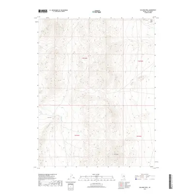
2018 Map of Callaway Well
USGS Topo · Published 2018About this map
Callaway Well serves as a remote point of interest in this high-desert landscape of Nye County, where the topography is defined by the significant elevations of the White River Range and the Horse Range. The terrain is marked by a network of drainage patterns, most notably the seasonal course of The Big Wash, which cuts through the central portion of the survey. This 2018 data illustrates the expansive Public Land Survey System grid, including townships t10n r59e, t10n r60e, t9n r59e, and t9n r60e. The map provides a detailed view of the natural relief and the sparse infrastructure characteristic of this portion of Nevada, useful for understanding the isolation and geographical constraints of the Great Basin's interior ranges.
Find a feature on this map
8 named features on this map. Tap any name to fly to it.
Don’t see what you’re looking for? This feature index may not catch every label — zoom into the map to look around manually.
Map Details
Editions of this 2018 Callaway Well Map
This is the sole edition of this map. No revisions or reprints were ever made.
Other maps of this area

1956 · Lund
USGS Topo · 1:250,000

1957 · Currant Mtn
USGS Topo · 1:62,500

1960 · Lund
USGS Topo · 1:250,000

1964 · Currant
USGS Topo · 1:62,500

1964 · Currant Mtn
USGS Topo · 1:62,500

1969 · Moorman Spring NW
USGS Topo · 1:24,000

1969 · Moorman Spring
USGS Topo · 1:24,000
1978 · Douglas
USGS Topo · 1:24,000

1980 · Duckwater
USGS Topo · 1:100,000
1990 · Wells Station
USGS Topo · 1:24,000