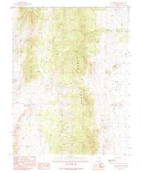
1990 Map of Callaway Well
USGS Topo · Published 1990About this map
Callaway Well serves as a vital anchor point in this high-desert landscape of Nevada-Nye County, illustrating the critical importance of water sources in an arid environment. The map shows a region defined by the topographic rise of the Horse Range and the sheltered depression of The Cove. Human presence is sparse, marked primarily by isolated outposts such as Stone Cabin and remote watering holes like Manzanita Well and Horse Tank. These features suggest a landscape utilized for livestock or seasonal movement, connected by a network of rugged 4wd tracks that provide the only passage through the high-elevation terrain. The density of contour lines reveals a territory where elevation and access to water dictate the pattern of human activity and survival.
Find a feature on this map
7 named features on this map. Tap any name to fly to it.
Don’t see what you’re looking for? This feature index may not catch every label — zoom into the map to look around manually.
Map Details
Editions of this 1990 Callaway Well Map
This is the sole edition of this map. No revisions or reprints were ever made.
Other maps of this area

1956 · Lund
USGS Topo · 1:250,000

1957 · Currant Mtn
USGS Topo · 1:62,500

1960 · Lund
USGS Topo · 1:250,000

1964 · Currant
USGS Topo · 1:62,500

1964 · Currant Mtn
USGS Topo · 1:62,500

1969 · Moorman Spring NW
USGS Topo · 1:24,000

1969 · Moorman Spring
USGS Topo · 1:24,000
1978 · Douglas
USGS Topo · 1:24,000

1980 · Duckwater
USGS Topo · 1:100,000
1990 · Wells Station
USGS Topo · 1:24,000