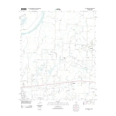
2013 Map of Callisburg
USGS Topo · Published 2013About this map
The Red River defines the northwestern boundary of this Cooke County landscape, where the rural settlements of Callisburg, Custer City, and Oak Ridge are connected by a network of farm roads and county lanes. The area south of the river is marked by several small water bodies including Leeper Lake and Lake Dealey, as well as numerous creek systems like Wheeler Cr and Buck Cr. Industry and community infrastructure are well-documented, notably through the Callisburg Oil Field and the local Callisburg Cem, Fairview Cem, and Center Hill Cem. The presence of Camp Sweeney and the Three Acres Airport indicates a mix of recreational and private aviation use. This 2013 survey provides a detailed look at the rural character of northern Texas just before significant modern expansion, preserving the locations of legacy family cemeteries and traditional local landmarks.
Find a feature on this map
71 named features on this map. Tap any name to fly to it.
Don’t see what you’re looking for? This feature index may not catch every label — zoom into the map to look around manually.
Map Details
Editions of this 2013 Callisburg Map
This is the sole edition of this map. No revisions or reprints were ever made.
Other maps of this area

1901 · Denison
USGS Topo · 1:125,000

1902 · Gainesville
USGS Topo · 1:125,000

1943 · Gainesville
USGS Topo · 1:125,000

1954 · Sherman
USGS Topo · 1:250,000

1958 · Gordonville
USGS Topo · 1:62,500

1958 · Whitesboro
USGS Topo · 1:62,500

1958 · Sherman
USGS Topo · 1:250,000

1960 · Callisburg
USGS Topo · 1:24,000

1960 · Gainesville South
USGS Topo · 1:24,000

1960 · Gainesville North
USGS Topo · 1:24,000