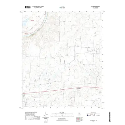
2019 Map of Callisburg
USGS Topo · Published 2019About this map
Gainesville anchors the southwestern corner of this survey, where residential streets like Hillside Dr and Rosedale Dr meet the arterial route of E Broadway St. The terrain is defined by a dense network of tributaries flowing toward the Red River, including Rock Cr, Wheeler Cr, and Indian Cr. This landscape is particularly rich for family historians, as it preserves the locations of numerous community burial grounds such as Callisburg Cem, Union Hill Cem, and Nelson Grove Cem. Between the established settlements of Callisburg and Oak Ridge, the map reveals a rural economy dependent on a intricate grid of county roads, with landmarks like Lake Dealey and Three Acres Airport dotting the countryside. The northern boundary is marked by the sweeping curve of the Red River, which separates Cooke County, Texas, from Love County, Oklahoma.
Find a feature on this map
110 named features on this map. Tap any name to fly to it.
Don’t see what you’re looking for? This feature index may not catch every label — zoom into the map to look around manually.
Map Details
Editions of this 2019 Callisburg Map
This is the sole edition of this map. No revisions or reprints were ever made.
Other maps of this area

1901 · Denison
USGS Topo · 1:125,000

1902 · Gainesville
USGS Topo · 1:125,000

1943 · Gainesville
USGS Topo · 1:125,000

1954 · Sherman
USGS Topo · 1:250,000

1958 · Gordonville
USGS Topo · 1:62,500

1958 · Whitesboro
USGS Topo · 1:62,500

1958 · Sherman
USGS Topo · 1:250,000

1960 · Callisburg
USGS Topo · 1:24,000

1960 · Gainesville South
USGS Topo · 1:24,000

1960 · Gainesville North
USGS Topo · 1:24,000