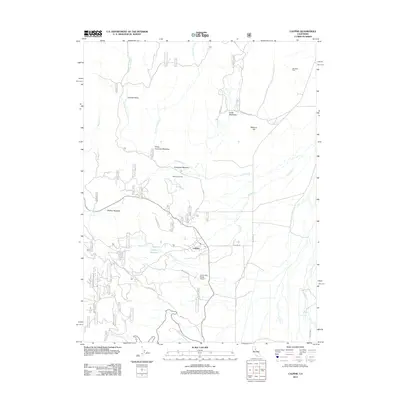
2012 Map of Calpine
USGS Topo · Published 2012About this map
Carman Valley and its network of alpine meadows anchor this high-altitude landscape in Sierra County. The small community of Calpine serves as a central hub, featuring a local Po and the nearby Calpine Reservoir. The surrounding terrain is defined by distinct named clearings such as Folchi Meadows, Knuthson Meadow, and McNair Meadow, which hint at the region's history of ranching and high-country grazing. Waterways like Carman Cr and Fletcher Cr drain the slopes of McElroy Hill, while forest routes like Forest Rte 09 and Mt Quail Rd provide access through the timbered landscape. For those tracing local history or family ties, Westside Cem and the Totem Pole Ranch Airport offer specific points of interest within the quadrangle.
Find a feature on this map
26 named features on this map. Tap any name to fly to it.
Don’t see what you’re looking for? This feature index may not catch every label — zoom into the map to look around manually.
Map Details
Editions of this 2012 Calpine Map
This is the sole edition of this map. No revisions or reprints were ever made.
Other maps of this area

1890 · Sierraville
USGS Topo · 1:125,000

1891 · Downieville
USGS Topo · 1:125,000

1892 · Sierraville
USGS Topo · 1:125,000

1893 · Downieville
USGS Topo · 1:125,000

1894 · Sierraville
USGS Topo · 1:125,000

1895 · Downieville
USGS Topo · 1:125,000

1896 · Downieville
USGS Topo · 1:125,000

1897 · Downieville
USGS Topo · 1:125,000

1937 · Blairsden
USGS Topo · 1:48,000

1943 · Blairsden
USGS Topo · 1:62,500