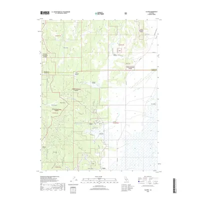
2018 Map of Calpine
USGS Topo · Published 2018About this map
Calpine sits at the edge of the expansive Sierra Valley and the Mohawk Valley, serving as a gateway between the forested peaks of the Plumas National Forest and Tahoe National Forest. The landscape is defined by its transition from high mountain meadows like Knuthson Meadow and Folchi Meadows to the broader flatlands toward Sattley. Local landmarks include the Calpine Reservoir and the Totem Pole Ranch Airport, which reflect the region's mid-century aviation and water management needs. The presence of the Westside Cem on the northern edge provides a historical anchor for the community. The map traces several drainages including Carman Cr and Fletcher Cr, which have historically shaped the grazing and settlement patterns of this Sierra County enclave.
Find a feature on this map
53 named features on this map. Tap any name to fly to it.
Don’t see what you’re looking for? This feature index may not catch every label — zoom into the map to look around manually.
Map Details
Editions of this 2018 Calpine Map
This is the sole edition of this map. No revisions or reprints were ever made.
Other maps of this area

1890 · Sierraville
USGS Topo · 1:125,000

1891 · Downieville
USGS Topo · 1:125,000

1892 · Sierraville
USGS Topo · 1:125,000

1893 · Downieville
USGS Topo · 1:125,000

1894 · Sierraville
USGS Topo · 1:125,000

1895 · Downieville
USGS Topo · 1:125,000

1896 · Downieville
USGS Topo · 1:125,000

1897 · Downieville
USGS Topo · 1:125,000

1937 · Blairsden
USGS Topo · 1:48,000

1943 · Blairsden
USGS Topo · 1:62,500