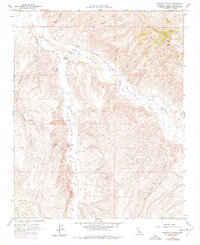
1961 Map of Camatta Canyon
USGS Topo · Published 1978About this map
San Juan Creek meanders through this portion of eastern San Luis Obispo County, shaping a landscape defined by deep canyons and the rising slopes of the Temblor Range. Surveyed in the early 1960s, the map reveals a rural economy centered on agriculture and grazing, evidenced by scattered grain labels and isolated operations like Alfalfa Ranch and Canyon Ranch. The network of Jeep Trails and Truesdale Road suggests a terrain that required rugged transport for land management and mineral exploration, as indicated by a lone mine symbol in the eastern hills. Prominent landmarks such as VABM 1717 Commatti and VABM Red 2578 in the Red Hills provide significant surveying control points across the ridges of Camatta Canyon.
Find a feature on this map
21 named features on this map. Tap any name to fly to it.
Don’t see what you’re looking for? This feature index may not catch every label — zoom into the map to look around manually.
Map Details
Editions of this 1961 Camatta Canyon Map
3 editions found
Other maps of this area

1914 · Cholame
USGS Topo · 1:125,000

1915 · Cholame
USGS Topo · 1:125,000

1917 · Cholame
USGS Topo · 1:125,000

1922 · Pozo
USGS Topo · 1:62,500

1932 · La Panza
USGS Topo · 1:48,000

1935 · La Panza
USGS Topo · 1:62,500

1936 · La Panza
USGS Topo · 1:62,500

1943 · Grant Lake
USGS Topo · 1:31,680

1943 · Shandon
USGS Topo · 1:31,680

1943 · Commatti Canyon
USGS Topo · 1:31,680