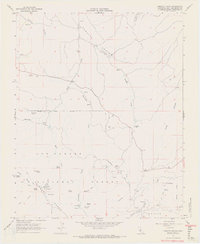
1966 Map of Camatta Ranch
USGS Topo · Published 1968About this map
The ranching and forest lands of the La Panza Range dominate this mid-century survey of eastern San Luis Obispo County. Centered on the Camatta Ranch, the landscape is defined by the drainage networks of Camatta Creek and Shell Creek as they cut through the Camatta Canyon. This era shows a working landscape of remote outposts, including the Bethal Ranch and several prospects tucked into the canyon walls. High-elevation points are utilized for infrastructure, notably the Radio Facility and Chiches 2 Lookout atop Black Mtn. The survey captures a transition in backcountry access, where Hernandez Road and various jeep trails provide the primary movement through the Los Padres National Forest. The presence of numerous named springs, such as Wild Horse Spring and Blue Oak Spring, highlights the critical importance of water sources for both livestock and forest management in this arid terrain.
Find a feature on this map
39 named features on this map. Tap any name to fly to it.
Don’t see what you’re looking for? This feature index may not catch every label — zoom into the map to look around manually.
Map Details
Editions of this 1966 Camatta Ranch Map
2 editions found
Other maps of this area

1914 · Cholame
USGS Topo · 1:125,000

1915 · Cholame
USGS Topo · 1:125,000

1917 · Cholame
USGS Topo · 1:125,000

1922 · Pozo
USGS Topo · 1:62,500

1932 · La Panza
USGS Topo · 1:48,000

1935 · La Panza
USGS Topo · 1:62,500

1936 · La Panza
USGS Topo · 1:62,500

1943 · Grant Lake
USGS Topo · 1:31,680

1943 · Commatti Canyon
USGS Topo · 1:31,680

1943 · Shedd Canyon
USGS Topo · 1:31,680