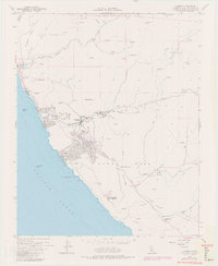
1959 Map of Cambria
USGS Topo · Published 1979About this map
Cambria and its neighboring valleys are captured here during a period of transition, reflecting both its coastal ranching roots and mid-century strategic importance. The map details the residential expansion south of Santa Rosa Creek, including the layout of streets like Ardath and Chester Lane. To the southeast, the Cambria Air Force Station and its associated water tanks sit atop the coastal terrace, a significant Cold War-era landmark overlooking the Pacific Ocean.
Find a feature on this map
33 named features on this map. Tap any name to fly to it.
Don’t see what you’re looking for? This feature index may not catch every label — zoom into the map to look around manually.
Map Details
Editions of this 1959 Cambria Map
4 editions found
Other maps of this area

1897 · Cayucos
USGS Topo · 1:62,500

1900 · San Luis
USGS Topo · 1:125,000

1919 · Adelaida
USGS Topo · 1:62,500

1919 · San Simeon
USGS Topo · 1:62,500

1932 · Adelaida
USGS Topo · 1:62,500

1937 · Cayucos
USGS Topo · 1:62,500

1937 · San Simeon
USGS Topo · 1:62,500

1942 · Adelaida
USGS Topo · 1:62,500

1943 · Cayucos
USGS Topo · 1:62,500

1947 · San Luis Obispo
USGS Topo · 1:250,000