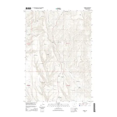
2015 Map of Cambria
USGS Topo · Published 2015About this map
Cambria and the northern reaches of Newcastle anchor this map of eastern Wyoming, where the terrain is carved by a complex network of canyons and draws. The settlement at Cambria sits between Antelope Flats and Camp Canyon, serving as a focal point for researchers interested in the historical development of Weston County. Further north, Cambria Cemetery remains a significant marker of local history. The landscape is defined by dramatic elevation changes at Mt Pisgah and Breakneck Hill, with water sources like Salt Spring and Cave Spring providing vital points in an otherwise arid environment. Numerous draws, including Deadman Draw, Feralla Draw, and Buck Pasture Draw, drain into local creeks such as Salt Creek and Fourmile Creek. The placement of Jumbo Table and South Table Draw indicates the characteristic flat-topped mesas that dominate this region's geography.
Find a feature on this map
49 named features on this map. Tap any name to fly to it.
Don’t see what you’re looking for? This feature index may not catch every label — zoom into the map to look around manually.
Map Details
Editions of this 2015 Cambria Map
This is the sole edition of this map. No revisions or reprints were ever made.
Other maps of this area

1898 · Sundance
USGS Topo · 1:125,000

1899 · Newcastle
USGS Topo · 1:125,000

1901 · Newcastle
USGS Topo · 1:125,000

1902 · Sundance
USGS Topo · 1:125,000

1951 · Newcastle
USGS Topo · 1:24,000

1951 · Fanny Peak
USGS Topo · 1:24,000

1951 · Osage SE
USGS Topo · 1:24,000

1954 · Gillette
USGS Topo · 1:250,000

1955 · Newcastle
USGS Topo · 1:250,000

1955 · Gillette
USGS Topo · 1:250,000