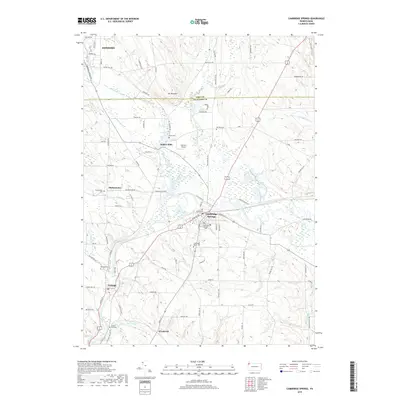
2019 Map of Cambridge Springs
USGS Topo · Published 2019About this map
French Creek carves a winding path through this corner of Crawford County, defining the local geography as it flows past Cambridge Springs and Venango. This 2019 survey illustrates a landscape where small rural settlements like Drakes Mills and Skeltontown are connected by a network of historic roads, including Old State Hwy 86. The boundary between Erie and Crawford counties bisects the northern half of the map, just south of Edinboro.
Find a feature on this map
90 named features on this map. Tap any name to fly to it.
Don’t see what you’re looking for? This feature index may not catch every label — zoom into the map to look around manually.
Map Details
Editions of this 2019 Cambridge Springs Map
This is the sole edition of this map. No revisions or reprints were ever made.
Other maps of this area

1923 · Meadville
USGS Topo · 1:62,500

1923 · Cambridge Springs
USGS Topo · 1:62,500

1925 · Meadville
USGS Topo · 1:62,500

1925 · Cambridge Springs
USGS Topo · 1:62,500

1927 · Townville
USGS Topo · 1:48,000

1929 · Union City
USGS Topo · 1:62,500

1932 · Townville
USGS Topo · 1:62,500

1932 · Union City
USGS Topo · 1:62,500

1943 · Meadville
USGS Topo · 1:62,500

1943 · Cambridge Springs
USGS Topo · 1:62,500