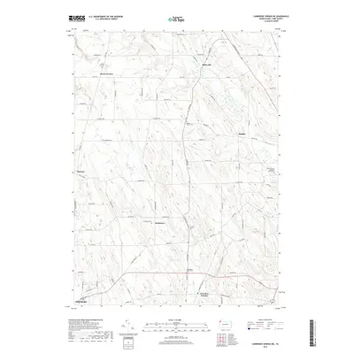
2019 Map of Cambridge Springs NE
USGS Topo · Published 2019About this map
Little Conneautee Creek and Darrow Creek carve through the agricultural uplands of Erie County in this modern survey. The map details a landscape defined by historically significant crossroads and small hamlets, including Draketown, Sibleyville, and McLallen Corners. These small clusters of settlement are often anchored by local heritage sites, such as the Draketown Cemetery and the Washington Valley Cemetery, which offer valuable coordinates for genealogical research. The northern extent is marked by Elk Creek near Reeds Corners, while the southern edge touches the outskirts of Edinboro. This 2019 data illustrates the persistent rural road network, with thoroughfares like Old State Road and Waterford Pike Road connecting these long-standing communities across the rolling terrain between Lake Erie and the southern highlands.
Find a feature on this map
76 named features on this map. Tap any name to fly to it.
Don’t see what you’re looking for? This feature index may not catch every label — zoom into the map to look around manually.
Map Details
Editions of this 2019 Cambridge Springs NE Map
This is the sole edition of this map. No revisions or reprints were ever made.
Other maps of this area

1899 · Erie
USGS Topo · 1:62,500

1900 · Erie
USGS Topo · 1:62,500

1913 · North East
USGS Topo · 1:62,500

1915 · North East
USGS Topo · 1:62,500

1923 · Cambridge Springs
USGS Topo · 1:62,500

1925 · Cambridge Springs
USGS Topo · 1:62,500

1929 · Union City
USGS Topo · 1:62,500

1932 · Union City
USGS Topo · 1:62,500

1943 · North East
USGS Topo · 1:62,500

1943 · Cambridge Springs
USGS Topo · 1:62,500
Featured Places
- McKean Township, PA
- McLallen Corners, PA
- LeBoeuf Township, PA
- Washington Township, PA
- Waterford Township, PA