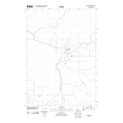
2010 Map of Cambridge
USGS Topo · Published 2010About this map
Cambridge serves as the focal point of this 2010 survey, situated where Pine Creek and Rush Creek meet the Weiser River. The geography is defined by the broad Salubria Valley, a landscape shaped by both natural waterways and man-made irrigation like the Middle Valley Ditch. The settlement of Salubria lies just south of the main town, connected by a network of local roads that hint at the area's agricultural and transportation history.
Find a feature on this map
34 named features on this map. Tap any name to fly to it.
Don’t see what you’re looking for? This feature index may not catch every label — zoom into the map to look around manually.
Map Details
Editions of this 2010 Cambridge Map
This is the sole edition of this map. No revisions or reprints were ever made.
Other maps of this area

1897 · Weiser
USGS Topo · 1:125,000

1953 · Mann Creek
USGS Topo · 1:62,500

1955 · Baker
USGS Topo · 1:250,000

1957 · Cambridge
USGS Topo · 1:62,500

1957 · Crane Creek Reservoir
USGS Topo · 1:62,500

1957 · Sturgill Peak
USGS Topo · 1:62,500

1959 · Baker
USGS Topo · 1:250,000

1980 · McCall
USGS Topo · 1:100,000

1980 · Weiser
USGS Topo · 1:100,000
1986 · East of Cambridge
USGS Topo · 1:24,000