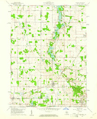
1960 Map of Camden
USGS Topo · Published 1961About this map
The New York Central railroad corridor serves as the primary industrial axis through this corner of Hillsdale County, connecting the villages of Montgomery and Camden. Situated at the border where Michigan meets Indiana and Ohio, the landscape is defined by the glacial hydrology of the West Branch St Joseph River and a dense cluster of kettle lakes. In the northern sections, rural social centers like East Algansee Ch and West Reading Ch anchor farming communities, while family legacies are preserved in sites such as Maple Lawn Cem and Gleason Cem. The 1960 survey captures a period when regional transit still relied heavily on these established rail lines and local gravel extraction, with numerous Gravel Pits dotting the terrain near Long Lake and Turner Lake. The presence of Kimball Camp and a Gazing Station suggests a landscape utilized for both local industry and early recreation.
Find a feature on this map
46 named features on this map. Tap any name to fly to it.
Don’t see what you’re looking for? This feature index may not catch every label — zoom into the map to look around manually.
Map Details
Editions of this 1960 Camden Map
2 editions found
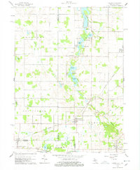
Other maps of this area

1914 · Pioneer
USGS Topo · 1:62,500

1939 · Angola East
USGS Topo · 1:24,000

1939 · Clear Lake
USGS Topo · 1:24,000

1940 · Clear Lake
USGS Topo · 1:24,000

1944 · Pioneer
USGS Topo · 1:62,500

1947 · Angola East
USGS Topo · 1:24,000

1953 · Fort Wayne
USGS Topo · 1:250,000

1956 · Fort Wayne
USGS Topo · 1:250,000

1959 · Hillsdale
USGS Topo · 1:24,000

1959 · Reading
USGS Topo · 1:24,000