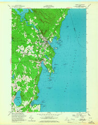
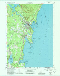
1955 Map of Camden
USGS Topo · Published 1967About this map
Mount Battie stands watch over the mid-coast harbor of Camden in the mid-1950s, a period when the local economy balanced its maritime roots with growing tourism and residential expansion. This survey details the transition from the steep elevations of Bald Mountain and the Camden Hills State Park down to the bustling waterfronts of Rockport Harbor and the northern edge of Rockland. Inland, smaller agricultural and residential clusters like Melvin Heights and Simonton Corners are visible alongside specialized landmarks like the Fish Hatchery near Megunticook Lake. The coastline is heavily marked with navigational aids and hazards such as Curtis Island, Dillingham Ledge, and Porterfield Ledge, reflecting the active seafaring nature of Penobscot Bay. For the local historian, the map preserves the locations of several burial grounds, including Oak Hill Cem and Ames Cem, alongside mid-century entertainment like the Drive-in Theater in Rockport.
Find a feature on this map
66 named features on this map. Tap any name to fly to it.
Don’t see what you’re looking for? This feature index may not catch every label — zoom into the map to look around manually.
Map Details
Editions of this 1955 Camden Map
5 editions found
Other maps of this area

1902 · Castine
USGS Topo · 1:62,500

1904 · Castine
USGS Topo · 1:62,500

1904 · Vinalhaven
USGS Topo · 1:62,500

1904 · Rockland
USGS Topo · 1:62,500

1905 · Penobscot Bay
USGS Topo · 1:125,000

1906 · Rockland
USGS Topo · 1:62,500

1915 · Belfast
USGS Topo · 1:62,500

1917 · Belfast
USGS Topo · 1:62,500

1941 · Belfast
USGS Topo · 1:62,500

1941 · Rockland
USGS Topo · 1:62,500