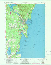
1955 Map of Camden
USGS Topo · Published 1989About this map
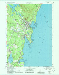
Camden Hills State Park dominates the northern landscape of this mid-coast Maine survey, where the heights of Mount Megunticook and Mount Battie overlook the bustling harbors of Camden and Rockport. The map illustrates a coastal economy in transition, featuring the long-established waterfronts alongside a growing recreational footprint represented by a Golf Course and Drive-in Theater. Genealogists will find significant value in the numerous burial grounds documented across the townships, including Mountain View Cem, Oak Hill Cem, and the Amsbury Cem. Inland, smaller settlements like Simonton Corners and Melvin Heights sit along the winding routes of Cobb Road and Washington St, while the Goose River and Megunticook Lake provide the primary freshwater drainage for the region. The southern edge of the sheet captures the northern reaches of Rockland, showing the residential expansion toward Glen Cove and Clam Cove.
Find a feature on this map
73 named features on this map. Tap any name to fly to it.
Don’t see what you’re looking for? This feature index may not catch every label — zoom into the map to look around manually.
Map Details
Editions of this 1955 Camden Map
5 editions found
Other maps of this area

1902 · Castine
USGS Topo · 1:62,500

1904 · Castine
USGS Topo · 1:62,500

1904 · Vinalhaven
USGS Topo · 1:62,500

1904 · Rockland
USGS Topo · 1:62,500

1905 · Penobscot Bay
USGS Topo · 1:125,000

1906 · Rockland
USGS Topo · 1:62,500

1915 · Belfast
USGS Topo · 1:62,500

1917 · Belfast
USGS Topo · 1:62,500

1941 · Belfast
USGS Topo · 1:62,500

1941 · Rockland
USGS Topo · 1:62,500