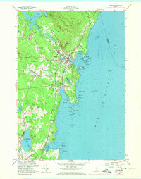
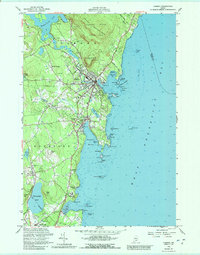
1955 Map of Camden
USGS Topo · Published 1974About this map
Camden Hills State Park dominates the northern coast of this mid-century survey, where the peaks of Bald Mountain and Mount Megunticook overlook the transition from freshwater Megunticook Lake to the salt waters of Penobscot Bay. The landscape reveals a coastal economy balancing tourism and maritime industry, shown through the cluster of Rockport Harbor and the Golf Course at Beauchamp Pt. Settlements like Simonton Corners and Melvin Heights sit inland from the active waterfronts, while navigation is maintained by several lighthouses including Curtis Island Light(C) and Goose Rock Light(C).
Find a feature on this map
77 named features on this map. Tap any name to fly to it.
Don’t see what you’re looking for? This feature index may not catch every label — zoom into the map to look around manually.
Map Details
Editions of this 1955 Camden Map
5 editions found
Other maps of this area

1902 · Castine
USGS Topo · 1:62,500

1904 · Castine
USGS Topo · 1:62,500

1904 · Vinalhaven
USGS Topo · 1:62,500

1904 · Rockland
USGS Topo · 1:62,500

1905 · Penobscot Bay
USGS Topo · 1:125,000

1906 · Rockland
USGS Topo · 1:62,500

1915 · Belfast
USGS Topo · 1:62,500

1917 · Belfast
USGS Topo · 1:62,500

1941 · Belfast
USGS Topo · 1:62,500

1941 · Rockland
USGS Topo · 1:62,500