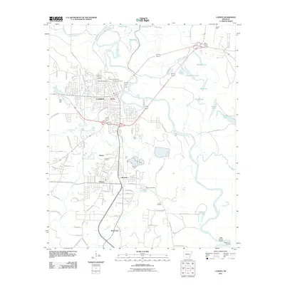
2011 Map of Camden
USGS Topo · Published 2011About this map
The Ouachita River defines this landscape as it meanders through the heart of Camden, carving a complex network of oxbow lakes and bayous. To the north, Ecore Fabre Bayou and Palmer Bayou feed into Hook Lake and Fishers Lake, while the river's path south is marked by Little Buffalo Shoals and Cape Horn Shoals. The urban footprint of Camden extends into the adjacent communities of Cullendale, Fairview, and Herbert, revealing a dense grid of streets and residential development.
Find a feature on this map
91 named features on this map. Tap any name to fly to it.
Don’t see what you’re looking for? This feature index may not catch every label — zoom into the map to look around manually.
Map Details
Editions of this 2011 Camden Map
This is the sole edition of this map. No revisions or reprints were ever made.
Other maps of this area

1903 · Camden
USGS Topo · 1:125,000

1951 · Camden
USGS Topo · 1:24,000

1953 · El Dorado
USGS Topo · 1:250,000

1957 · El Dorado
USGS Topo · 1:250,000

1958 · El Dorado
USGS Topo · 1:250,000

1960 · El Dorado
USGS Topo · 1:250,000

1962 · Louann
USGS Topo · 1:24,000

1962 · Buena Vista
USGS Topo · 1:24,000

1962 · Snow Hill
USGS Topo · 1:24,000

1964 · Smackover
USGS Topo · 1:62,500