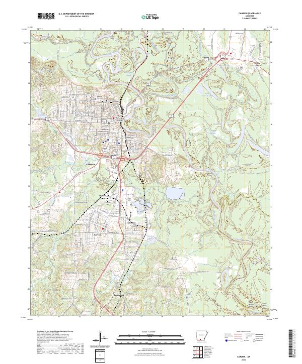
2024 Map of Camden
USGS Topo · Published 2024About this map
The Ouachita River defines the landscape of this southern Arkansas corridor, winding through a complex network of oxbows and bayous including Newman Slough, Hook Lake, and Palmer Bayou. The settlement pattern centers on Camden and its industrial and residential satellites, such as Cullendale, Fairview, and East Camden. Local heritage is deeply etched into the town plan, from the Ouachita County Courthouse to a high concentration of significant burial grounds, including the Confederate Cem, Jewish Rest Cem, and Greenwood Cem. To the east, Harrell Field and the community of Rendezvous sit near the river's edge, while the southern reach of the map follows the waterway toward Little Buffalo Shoals. The transition from the urban grid of Herbert to the dense creek systems of Two Bayou and Mizzell Creek illustrates the area's development alongside its flood-prone lowlands.
Find a feature on this map
166 named features on this map. Tap any name to fly to it.
Don’t see what you’re looking for? This feature index may not catch every label — zoom into the map to look around manually.
Map Details
Editions of this 2024 Camden Map
This is the sole edition of this map. No revisions or reprints were ever made.
Other maps of this area

1903 · Camden
USGS Topo · 1:125,000

1951 · Camden
USGS Topo · 1:24,000

1953 · El Dorado
USGS Topo · 1:250,000

1957 · El Dorado
USGS Topo · 1:250,000

1958 · El Dorado
USGS Topo · 1:250,000

1960 · El Dorado
USGS Topo · 1:250,000

1962 · Louann
USGS Topo · 1:24,000

1962 · Buena Vista
USGS Topo · 1:24,000

1962 · Snow Hill
USGS Topo · 1:24,000

1964 · Smackover
USGS Topo · 1:62,500