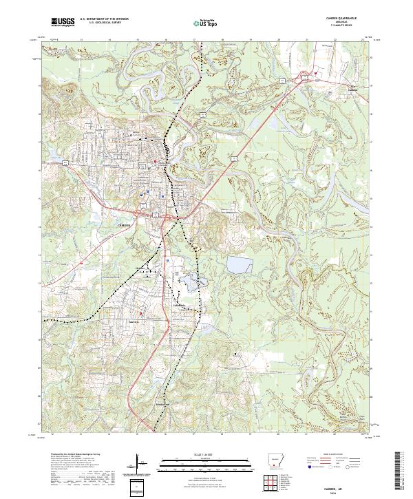
1951 Map of Camden
USGS Topo · Published 1951About this map
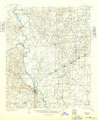
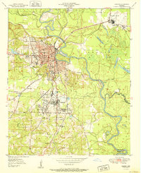
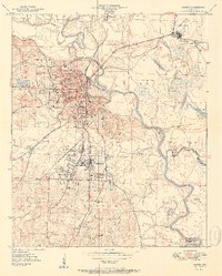
The Ouachita River snakes through the heart of this landscape, its tight oxbows and surrounding backwaters like Little Johnson Lake and Blue Lake defining the eastern lowlands. On higher ground to the west, Camden serves as a critical junction for the Missouri Pacific and St Louis Southwestern railroads. The industrial and civic footprint of the era is clear, with the Municipal Airport to the north and various educational institutions like Lincoln High School and Lafayette School serving the growing residential areas. Further south, the community of Cullendale sits adjacent to the sprawling Fairview district, highlighting the post-war expansion of the region. Evidence of an earlier river-dependent economy persists in labels such as Bradley Ferry (Aban'd), while numerous local landmarks like Radio Sta KAMD and the Courthouse anchor the town's mid-century identity.
Find a feature on this map
44 named features on this map. Tap any name to fly to it.
Don’t see what you’re looking for? This feature index may not catch every label — zoom into the map to look around manually.
Map Details
Editions of this 1951 Camden Map
2 editions found
Historical Maps of Camden Through Time
9 maps found