
1954 Map of Camels Back Ridge NW
USGS Topo · Published 1956About this map
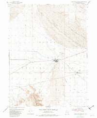
Dugway Proving Ground dominates this mid-century landscape in the Utah desert, revealing a complex network of military infrastructure established for testing and training. The map details highly specific functional zones including Dog Area, Charlie Area, and Able Area, which are connected by a system of specialized transport routes such as Goodyear Road and Stark Road. A central Landing Field and numerous tank installations underscore the area's strategic utility during the Cold War era.
Find a feature on this map
19 named features on this map. Tap any name to fly to it.
Don’t see what you’re looking for? This feature index may not catch every label — zoom into the map to look around manually.
Map Details
Editions of this 1954 Camels Back Ridge NW Map
2 editions found
Other maps of this area

1885 · Tooele Valley
USGS Topo · 1:250,000

1953 · Tooele
USGS Topo · 1:250,000

1954 · Dugway Proving Ground SE
USGS Topo · 1:24,000

1954 · Dugway Proving Ground NE
USGS Topo · 1:24,000

1955 · Tabbys Peak SE
USGS Topo · 1:24,000

1955 · Camels Back Ridge SW
USGS Topo · 1:24,000

1955 · Simpson Springs
USGS Topo · 1:24,000

1955 · Camels Back Ridge NE
USGS Topo · 1:24,000

1955 · Wig Mtn
USGS Topo · 1:24,000

1955 · Tabbys Peak SW
USGS Topo · 1:24,000