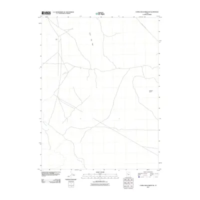
2011 Map of Camels Back Ridge SW
USGS Topo · Published 2011About this map
Camels Back Ridge and Simpson Buttes define the arid landscape of this Tooele County quadrangle, where the physical geography reveals a history of ancient water systems. The winding path of the Old River Bed cuts through the desert floor, tracing the prehistoric course of the waters that once drained Lake Bonneville. Man-made imprints on this remote terrain are sparse but distinct, centered around the industrial and military infrastructure of the Tower Grid. Access to this high-desert environment is limited to unpaved tracks like Simpson Buttes Rd, which skirts the eastern formations. This 2011 survey captures the area's transition between natural geological features and the strategic utility of the Great Salt Lake Desert, providing a detailed look at the hydrology and relief of the Basin and Range province.
Find a feature on this map
5 named features on this map. Tap any name to fly to it.
Don’t see what you’re looking for? This feature index may not catch every label — zoom into the map to look around manually.
Map Details
Editions of this 2011 Camels Back Ridge SW Map
This is the sole edition of this map. No revisions or reprints were ever made.
Other maps of this area

1885 · Sevier Desert
USGS Topo · 1:250,000

1885 · Tooele Valley
USGS Topo · 1:250,000

1908 · Fish Springs
USGS Topo · 1:250,000

1910 · Fish Springs
USGS Topo · 1:250,000

1953 · Dugway Range NE
USGS Topo · 1:24,000

1953 · Dugway Range
USGS Topo · 1:62,500

1953 · Tooele
USGS Topo · 1:250,000

1953 · Delta
USGS Topo · 1:250,000

1954 · Dugway Proving Ground SE
USGS Topo · 1:24,000

1954 · Dugway Proving Ground NE
USGS Topo · 1:24,000